| |
Wheeler Peak: 3,744' elevation gain
(4,600 cumulative), 16 miles. (Quick write-up
here) |
| |
My
friend and hiking partner in Texas came up with this
thought to hike all the highest peaks in each state. Come to find out,
it's not exactly an original idea, but it sounded fun. I was in Florida the time so
that should be an easy start! It was a grueling 25' hike from the car to Florida's high point!
The hardest part was actually finding it since I drove past it, not
realizing the little park was the location.
Fast
forward to back in NM. We're getting ready for Colorado's high point,
so I thought we'd give New Mexico's high point a try. Wow! 16
miles round trip with a cumulative elevation gain of 4600'! I'm glad I didn't
know the stats before-hand! The 4600' is "cumulative" because you
actually have to hike back down into a bowl before scaling another 1000'
to the peak. |
| |
|
|
| |
 |
 |
| |
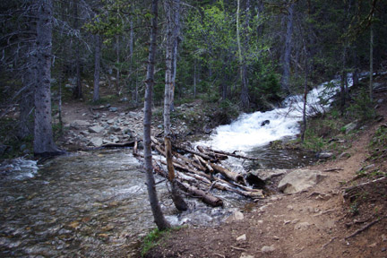
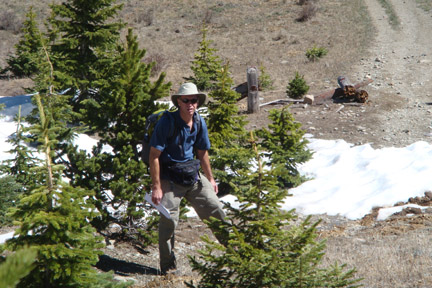
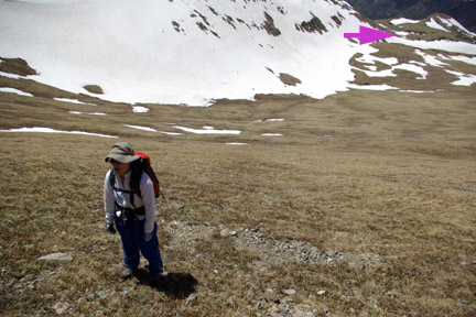
(0715) A 3 a.m. wake-up in Placitas and a 3+ hour
drive to the trailhead for about a 0730 start. |
Tip #1: Don't fall in or it's going to be a wet 11.5 hour
day!
(I took this picture on the return;
I was too hurried on the way up!) |
| |
|
|
| |
 |
 |
| |
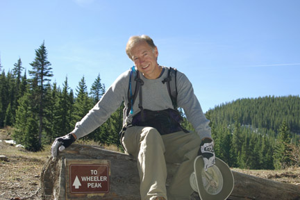
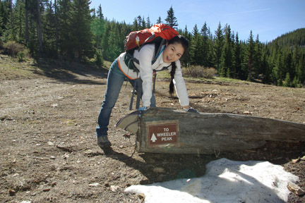
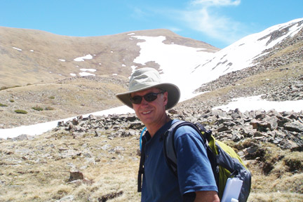
(0900) Technically this was already 1.5 hrs into the hike and
all I could think is how easy it was with the nice road for a trail! |
Kim is tired but doing well for her first real mountain
excursion. Little did we know how far and long this hike would be! |
| |
|
|
| |
 |
 |
| |
(1020) The trail/primitive road hits a T-intersection and
the view into the canyon is great. |
(1040) Now the, uh, fun starts! The trail abruptly ended
in snow (further uphill), and my maps weren't good enough to show the
detail. I walk back down and up looking for markers and am a bit
frustrated! Technology to the rescue as I get out my Droid smartphone
and download a Google map that actually shows the trail along with my GPS
position! Gotta love that! Result: as expected, plow through the
first of many snow fields. |
| |
|
|
| |
 |
 |
| |
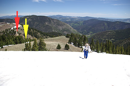
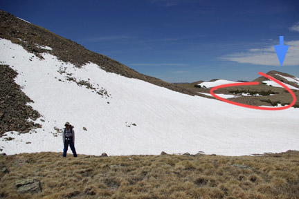
(1130) We cross our second snow field and this one is
large. The red
arrow shows where the primitive road ends and the yellow arrow is where I
initially lost the trail due to the first snow field. |
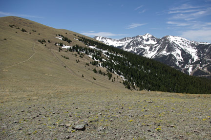
(1140) The long traverse can be seen to the left (I'm not
sure what the other trench is toward the middle of the picture). When
first getting here, I was slightly concerned our goal might've been one of
those brutal peaks in the distance! |
| |
|
|
| |
 |
 |
| |
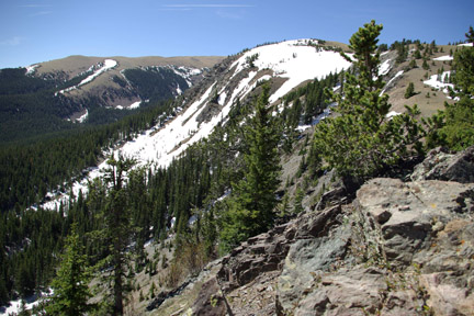
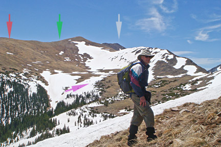
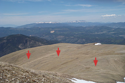
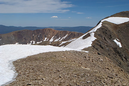
(1220) After the long traverse and up and over more snow, we
finally get our first look at Wheeler peak (gray arrow). I was really hoping it was
that closer one instead! This is also where the "cumulative" part of
elevation gain can be seen. The trail drops down from our current
elevation to near the purple arrow, then climbs up the switchbacks near the
red arrow. The trail turned too far downhill and got lost in the snow,
so we cut across the bowl and climbed straight up the ridge face at the
green arrow... |
(1315) The blue arrow is near where the previous picture was
taken where the traverse climbs up and over that ridge. We had to
cross that large snow field which is hard to tell, but drops down into a
ravine with melt water. Note the trees circled in red; they're not
huge, but they are bigger than us. |
| |
|
|
| |
 |
 |
| |
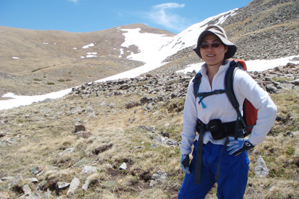
I'm ready... |
Kim's ready. |
| |
|
|
| |
 |
 |
| |
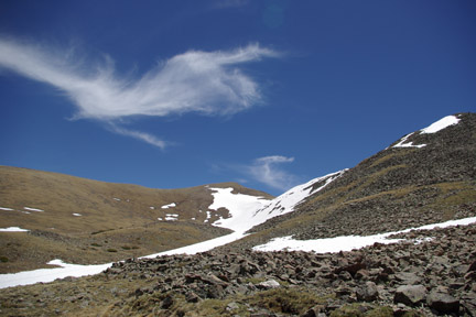
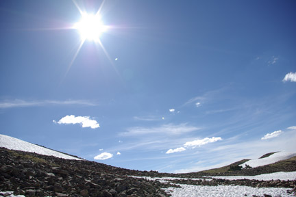
At least it's a beautiful day! |
(1400) Wow! Talk about blowing a lung! Climb
straight up a massive incline and this is the look of exhaustion! For
perspective, the purple arrow shows outcropping of trees from the previous
picture. |
| |
|
|
| |
 |
 |
| |
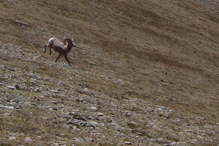
(1410) Near this point, we had a visitor. I happened to be
a bit further up the ridge than Kim when this guy started charging, and from
my perspective, right smack toward her! I start calling out and going
back down while she was calmly taking this picture! Fortunately, it
was not actually charging her! |
(1435) We made it to the ridgeline, and looking back you
can see the trail we didn't take, but instead joined it near the rightmost
arrow. |
| |
|
|
| |
 |
 |
| |
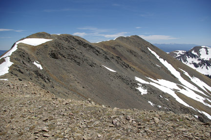
(1435) The ridgeline to the actual peak at the far end. |
(1435) Decision time. Well, right or wrong, looking
at the precarious walk along the ridgeline, the wind, the snow, the
exhaustion level and the late time of day, we made the decision that Kim
would stay here while I attempted the actual peak. I myself had
serious trepidation about making that walk and more than once thought about
just returning. |
| |
|
|
| |
 |
 |
| |
Awesome job! Her first mountain peak, and it was a
difficult one! |
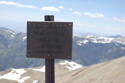
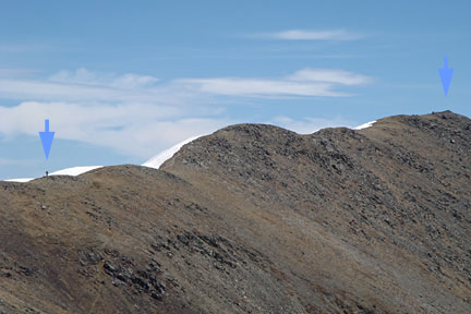
(1445) I'm moving now and looking only at my path (don't
look down)! I cross Mt Walter and debate again about making that last
stretch to Wheeler! |
| |
|
|
| |
 |
 |
| |
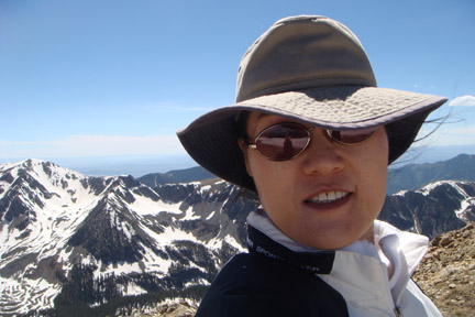
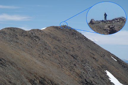
(1450) I'm on the left and the peak is on the
right. Don't. Look. Down. (Either side!) |
(1500) Just wow! Finally at the peak! |
| |
|
|
| |
 |
 |
| |
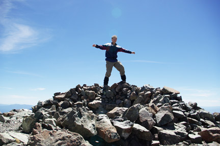
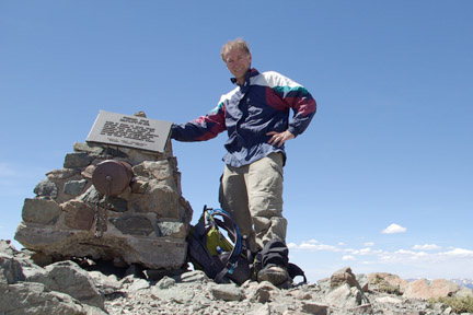
13,161' Okay, just don't fall! (8th highest
peak in the US.) |
Mission accomplished! Signed the registry. Time to
return. |
| |
|
|
| |
 |
 |
| |
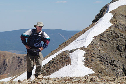
(1530) Rejoining Kim and wheezing hard! |
(1645) We're off the peak and in the basin before the
climb back up to the traverse. It's a long, long trek back to the car
and we finish at 1930. Twelve hours! That's a full day! |
| |
|
|